Year 9 Curriculum - Geography
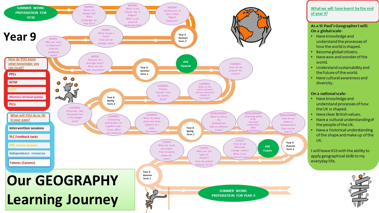
Year 9 Learning Journey
Coasts
- What shapes the coast?
- Erosion features
- Depositional features
- Living on the coast
- Coastal management
- Hard and soft engineering
- Coral reefs
- Sea levels rising
Development
- What is development?
- What are development indicators?
- How is the World divided?
- Employment around the world
- Challenging perceptions
- Rich and poor
- How can we improve quality of life?
Tectonic Hazards
- Where are the hazards of the world?
- What are the characteristics of plate boundaries?
- How do plates move?
- What are the processes that cause earthquakes and volcanoes?
- Can we ever prepare for natural hazard?
- Why do people live in the danger zone?
- Are hazards getting worse? Can we increase the risk or frequency?
Climatic Hazards
- How do storms form?
- What are the effects of tropical storms?
- How can we respond to these hazards?
- Comparing storms in HIC’s and LIC’s?
- Can we reduce the impact of storms?
River Features
- Where are the rivers of the world?
- What are the characteristics of a river?
- How does a river change down stream?
- What are the river processes?
- What features are formed in a river?
- What causes a river to flood?
- Where do we get flooding around the World?
- Where can we get flooding in the UK?
- What problems can flooding cause?
- What can we do to control rivers?
Global Cities
- What causes people to move to urban areas?
- How do the opportunities and challenges in urban areas vary around the World?
- How can cities be more sustainable?
- What changes have taken place where people live over time?
- Are the urban models appropriate today?
- How are population structures changing today?
- Can we manage and control a population?
Geographical skills
- Where in the World are we?
- Longitude and latitude?
- Grid references and map skills.
- Understanding maps
- How to draw graphs
- How to understand graphs
- How to interpret maps
- How to interpret images
